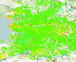
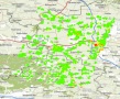
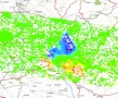
Products
Within the GMES (Global Monitoring for Environment and Security) Service Element (GSE) programme of the European Space Agency, the Terrafirma project is delivering satellite EO based Geohazard Land Motion Services. Its aim is to provide essential support in the process of risk assessment and mitigation by using the latest technology to measure terrain motion from satellite radar data. The ESA GMES project provides this support to a wide range of entities including: civil protection agencies, disaster management organisations and costal, rail and motorway authorities.
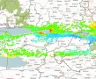
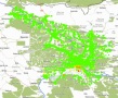
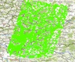
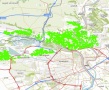
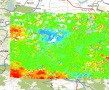
Using data acquired 800km above the Earth’s surface which is interpreted and analysed by expert national geoscience organisations, the project provides a pan-European ground motion hazard information service in each of the 27 states.
The first Stage (2003-2006) concentrated on the consolidation of a standardised and qualified terrain motion service.
In Stage 2 (2006-2009), the project focused on scaling up the service by delivering data to each of the 27 EU member states, and running a highly successful service validation, which established for the first time, a quantification of the precision and accuracy of the InSAR derived measurement services provided by the team.
The third stage of Terrafirma (2009-2013) focused on several thematic lines for terrain motion analysis: Tectonics, Coastal Lowland Subsidence and Flood Defence, Hydrogeology (ground water issues, landslides and inactive mines) and Wide Area Mapping service.
Within the consolidation of the GSE programme concerning land motion geohazard services, Stage 4 (2014) is devoted to secure the long-term on-line availability of Terrafirma products via the OneGeology-Europe Portal and to adapt the WAP processor to make it compatible with new data source. This represents a major step forward in being able to deliver terrain motion maps over wide areas using the Sentinel-1 satellites.
For more information, please visit the Terrafirma web site
For downloading data, you must agree to the License Terms and Conditions.
Terrafirma User License
By accessing, downloading and/or otherwise using the results from the Terrafirma project, you accept and agree to be bound by the terms of this license. Terrafirma is a project that originated within the GMES (Global Monitoring for Environment and Security) Service Element (GSE) programme of the European Space Agency, under the name Geohazard Land Motion (Terrafirma) Services.
1. GENERAL CONDITIONS
1.1 This license rules that the receipt of the dataset from the Terrafirma project is for non-commercial use only. Neither the PSI datasets nor any results derived from this Terrafirma data may be used for commercial purposes.
2. OBLIGATIONS OF THE USER
2.1 The user must acknowledge the copyright and source of the Terrafirma Data by including at least the following credits and logos on any product derived from the supplied information:
- – The Terrafirma logo and other recognition in a presentation or document that the work is part of Terrafirma.
- – The logo of the PSI Supplier who performed the PSI processing.
- – ESA copyright statement for the radar data used, taking the form ESA data copyright.
3. EXCLUSION OF LIABILITY
3.1. You acknowledge and agree that the Terrafirma Data is made available to you free of charge and the Terrafirma Data is provided on the express basis that the Terrafirma Data is provided “as is” and the licensors make no representation, warranty, promise or guarantee of any kind concerning the Terrafirma Data, whether express or implied by statute, common law, custom, trade usage, course of dealing or otherwise, all of which are hereby excluded to the fullest extent permitted by law. Without prejudice to the generality of the foregoing the licensors make no representation, warranty, promise or guarantee of any kind regarding: title to the Terrafirma Data; non-infringement of any third party rights through use of the Terrafirma Data; the accuracy or completeness or fitness for purpose of the Terrafirma Data; the absence of latent or other defects or the presence or absence of errors (whether or not discoverable) in the Terrafirma Data. It is your responsibility to ensure that the Terrafirma Data you use is suitable for the intended purpose.
3.2 The licensors shall not be liable to you for any special, indirect, consequential, punitive or exemplary damages arising out of these licence terms or your use of the Terrafirma Data.
3.3 Terrafirma data provides general and indicative information on geohazards and ground stability and the Terrafirma data should not be used to indicate the actual state of the land, risks of geohazards, or other risks to population or property present in any particular area.
3.4 The licensors have not verified Terrafirma data against other geo-risk data or reports and have not sought any professional opinions on risk, nor have they performed additional inspection of any of the sites.
3.5 Terrafirma data has been designed for general interest purposes and has not been designed for any particular use or purpose.
3.6 Terrafirma data has not been prepared to meet your or anyone else’s individual requirements.
3.7 Any use made of Terrafirma data is at your risk and the licensors shall not be liable for any use or reliance placed on the data by you or any third parties with whom you share the Terrafirma data or to whom you provide services using Terrafirma data.
4. GENERAL TERMS
4.1 Publishing results: ESA retains all rights to exploit the output from the Terrafirma project. Please note that, in general, ESA wishes to promote the EO Applications and will want to publish results including the interpretation of measurements present in some products.
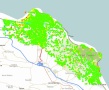
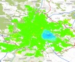
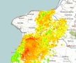
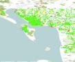
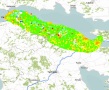
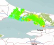
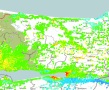
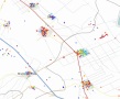
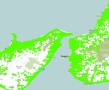
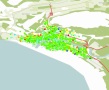
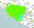
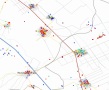
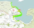
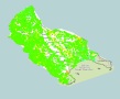
Calabria-Fabrizia
PSI supplier : TRE (2006-12-22, 2007-03-19, 2006-09-15, 2006-10-12)
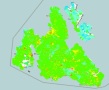
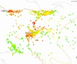
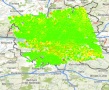
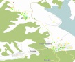
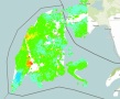
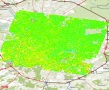
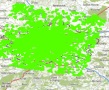
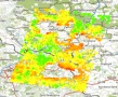
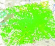
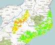
Calabria-Reggio
PSI supplier : TRE (2006-12-22, 2007-01-26, 2006-09-15, 2006-10-12)