Can I download the data from EGDI?

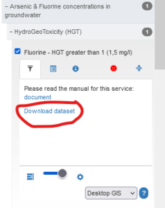
Some data can be downloaded. That applies to data uploaded as GeoPackages or Shapefiles. Sometimes, you can also download a PDF, TIFF, or similar file with the same content as the map shows. If the provider of the data has allowed it, such files can be downloaded from the left menu:
Other FAQs

I want to get in touch. How do I do that?
How can I get my own data on the EGDI map?
Do I need an account to get access to data?
What the INSPIRE directive is?
How can I search for datasets?
Will more data be available in the future in EGDI?
What is the difference between EGDI and EPOS
What does ATOM mean?
What does WMTS mean?
What a metadata catalogue is?
What a thesaurus is?
What a geographical map viewer is?
What is a WMS service, and how does it work?
What services are offered by any SDI?
What SDI means?